Photogrammetry
In addition to mobile 3D metrology, we are working for many years with the acquisition of large-scale spatial data using UAV systems, supported by photogrammetric processing methods. We handle all tasks from planning and realization to the goal- and customer-oriented compilation and presentation of the achieved results.
Principle of functionality
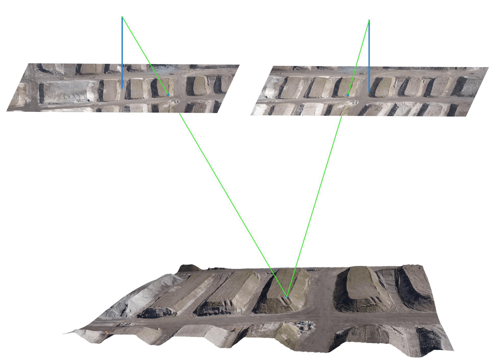
Photogrammetry describes a method in which spatial informations are extracted from two-dimensional photos. Features of each photo are analyzed and compared with the characteristics of the corresponding photos. The computer-based triangulation of the features makes it possible to calculate merged image sets with simultaneous camera calibration.
Point cloud and 3D model
The result of a photogrammetric process is a geo-referenced point cloud of the recorded area. The point cloud is triangulated and serves as the reference for the 3D model. The model describes a detailed map of the terrain topography and provides an exact representation of the actual situation. Classic areas of application include volume and mass calculations, break-edge extraction, but also periodic observations of changes (difference models).
Orthophoto
When calculating an orthophoto, individual photographs are projected onto a high-resolution surface model and rectified in scale. All perspective effects are corrected during this calculation. Thanks to an area-wide uniform scale, geometric accuracy is guaranteed in the entire orthophoto. Our systems enable large-area orthophotos with a resolution of a few centimetres per pixel. In this way our customers receive a high-resolution and geo-referenced orthophoto of the entire area.


Progress monitoring & planning
The orthophoto and the 3D model can be imported into various CAD software solutions such as Autocad as reference for planning and analysis. We combine the orthophoto with existing CAD data and can document the development of your building project in a geometrically exact and visually appealing way. Nominal / actual comparisons are visualized in a clearly comprehensible manner and allow area-wide monitoring of large construction sites within a very short time. As a result, our system saves a significant amount of time and money compared to classic terrestrial systems.


